File:TD Map SO.png

Size of this preview: 799 × 243 pixels. Other resolution: 1,739 × 529 pixels.
Original file (1,739 × 529 pixels, file size: 37 KB, MIME type: image/png)
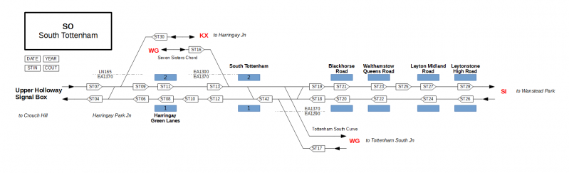
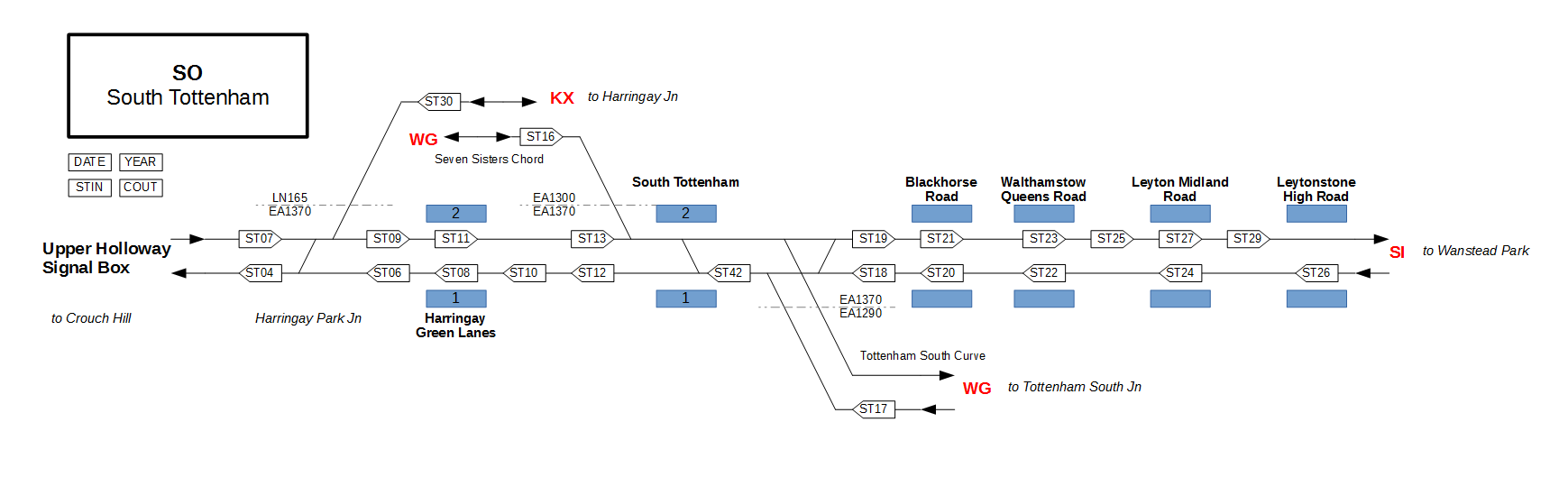
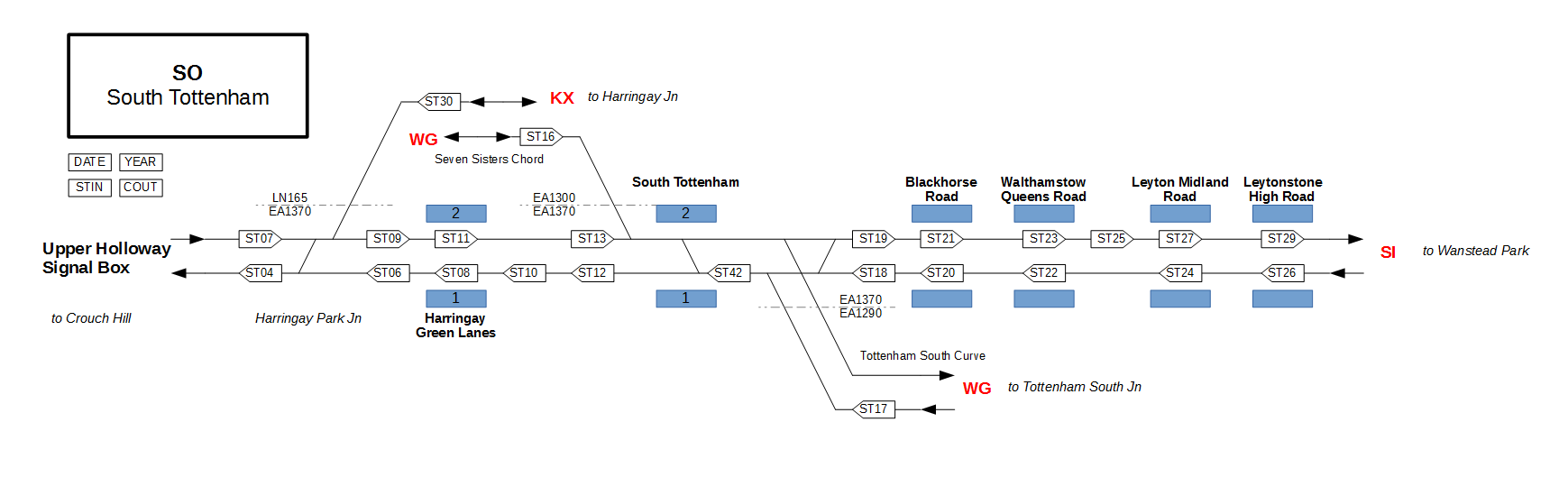
Map of TD area SO.
File history
Click on a date/time to view the file as it appeared at that time.
| Date/Time | Thumbnail | Dimensions | User | Comment | |
|---|---|---|---|---|---|
| current | 06:44, 10 January 2015 | 1,739 × 529 (37 KB) | Jpl (talk | contribs) | Reverted to version as of 16:28, 9 January 2015 | |
| 17:02, 9 January 2015 | 1,739 × 529 (37 KB) | Jpl (talk | contribs) | Minor correction. | ||
| 16:28, 9 January 2015 | 1,739 × 529 (37 KB) | Jpl (talk | contribs) | Map of TD area SO. |
You cannot overwrite this file.
File usage
The following page uses this file: