File list
Jump to navigation
Jump to search
This special page shows all uploaded files.
| Date | Name | Thumbnail | Size | User | Description | Versions |
|---|---|---|---|---|---|---|
| 19:51, 7 April 2016 | TIPLOC Eastings and Northings.xlsx.gz (file) | 383 KB | Q | TIPLOC Eastings and Northings released by Network Rail under FoI Ref: FOI2015-01334 | 1 | |
| 17:28, 1 April 2017 | TE VDU.gz (file) | 431 KB | Q | TE VDU Drawing | 1 | |
| 17:28, 1 April 2017 | TE Stepping Tables.tar.gz (file) | 415 KB | Q | TE Stepping Tables | 1 | |
| 17:27, 1 April 2017 | TE SOP.gz (file) | 13 KB | Q | TE SOP | 1 | |
| 22:08, 6 January 2015 | TD Map ZR.png (file) |  |
448 KB | Jpl | Map of TD area ZR. | 1 |
| 23:56, 27 July 2015 | TD Map ZE.png (file) |  |
75 KB | Jpl | Some minor corrections. | 3 |
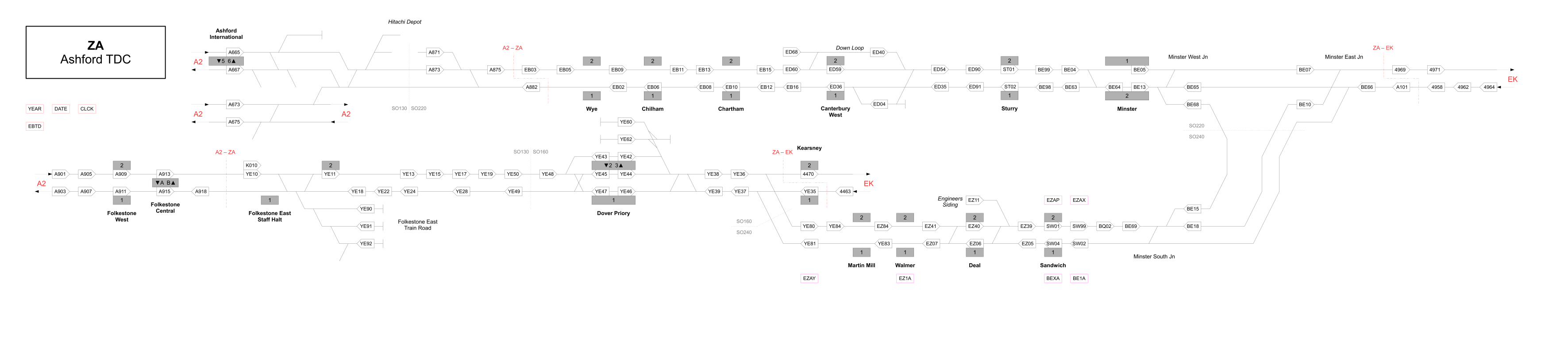
| 22:09, 6 January 2015 | TD Map ZA.png (file) | 193 KB | Jpl | Map of TD area ZA. | 1 | |
| 20:31, 6 April 2022 | TD Map XL.svg (file) | 64 KB | Jpl | 1 | ||
| 13:52, 3 April 2022 | TD Map XE.svg (file) | 43 KB | Jpl | 2 | ||
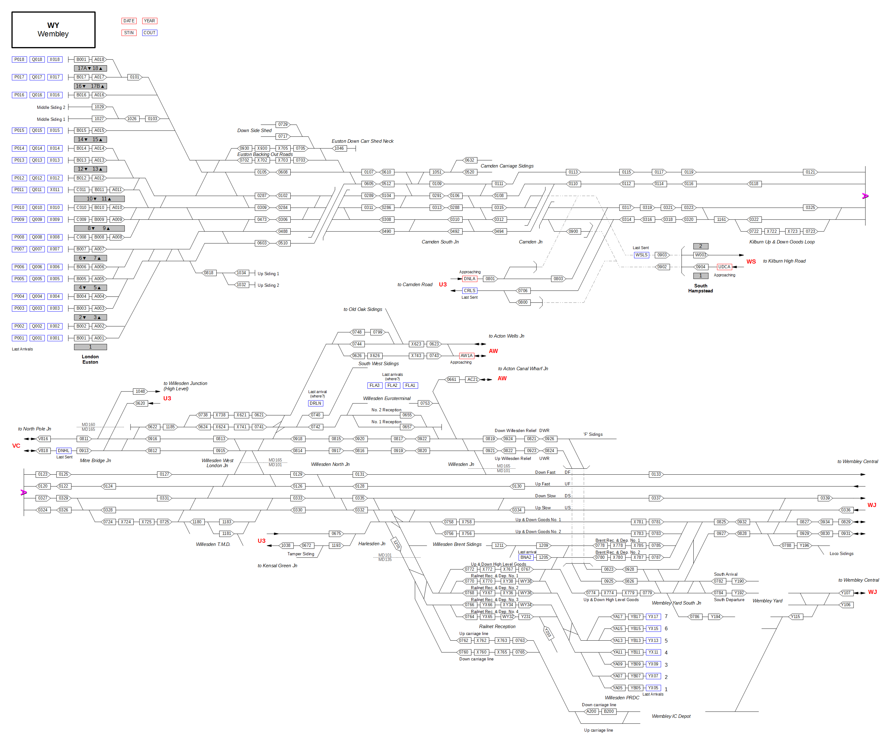
| 02:27, 5 February 2015 | TD Map WY.png (file) |  |
311 KB | Jpl | Map of TD area WY. | 1 |
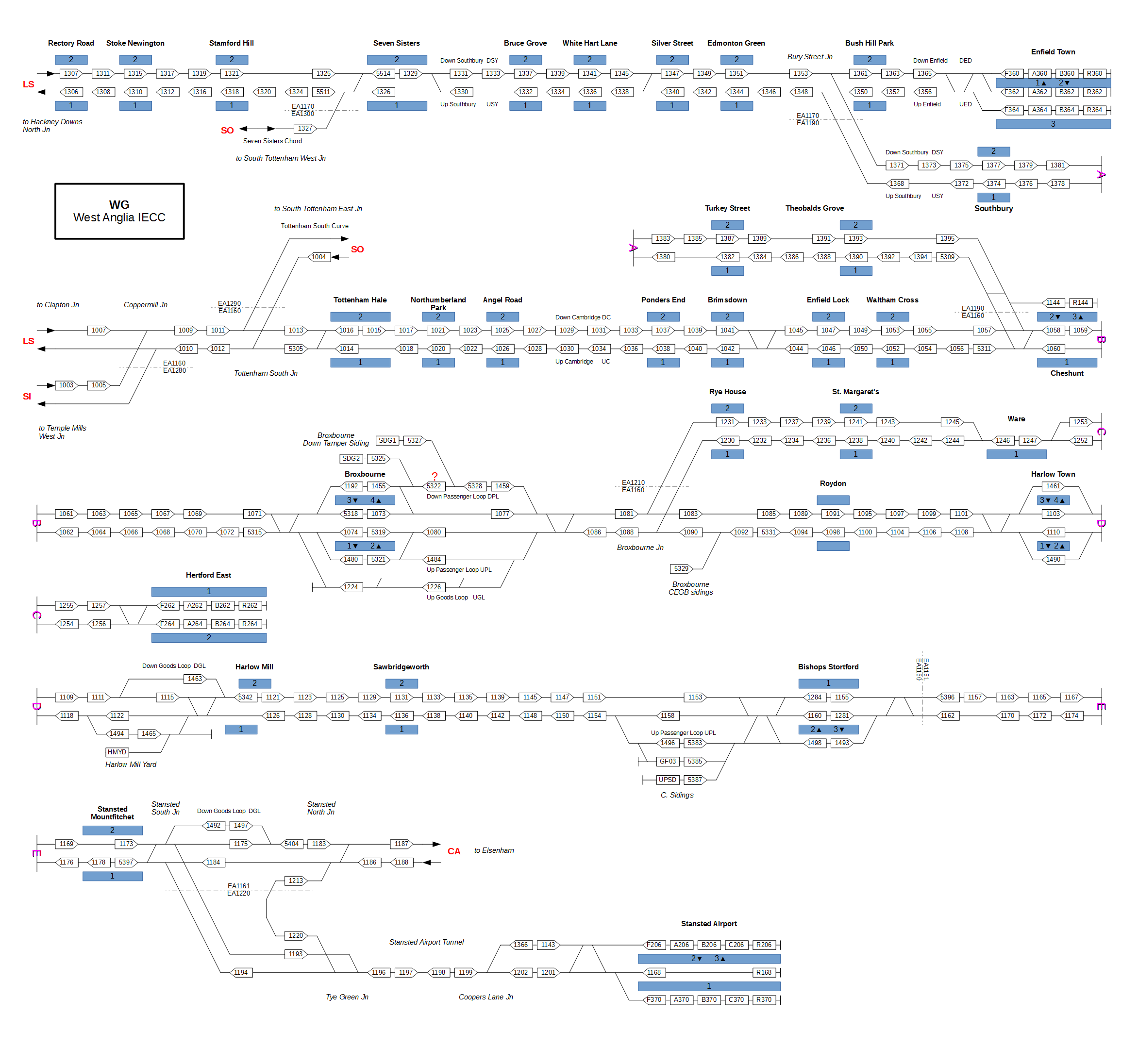
| 01:10, 9 January 2015 | TD Map WG.png (file) |  |
217 KB | Jpl | Better resolution. | 2 |
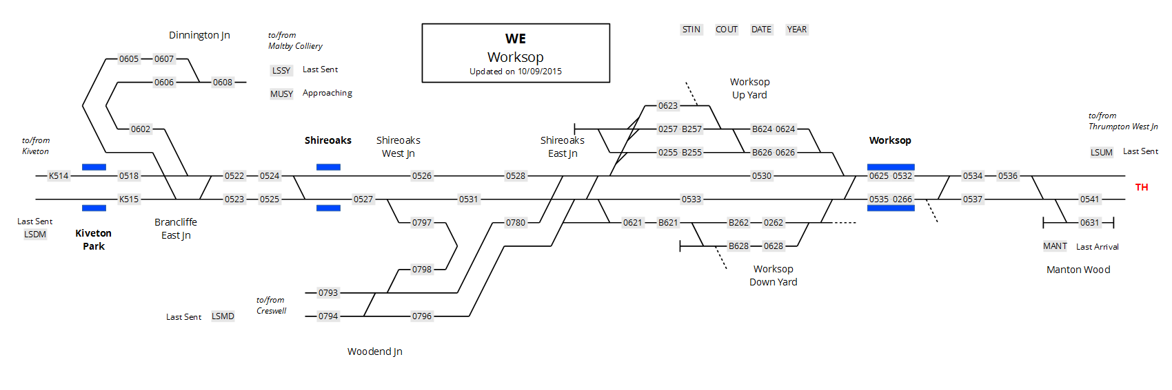
| 20:35, 10 September 2015 | TD Map WE.png (file) |  |
42 KB | Jpl | Map of TD area WE. | 1 |
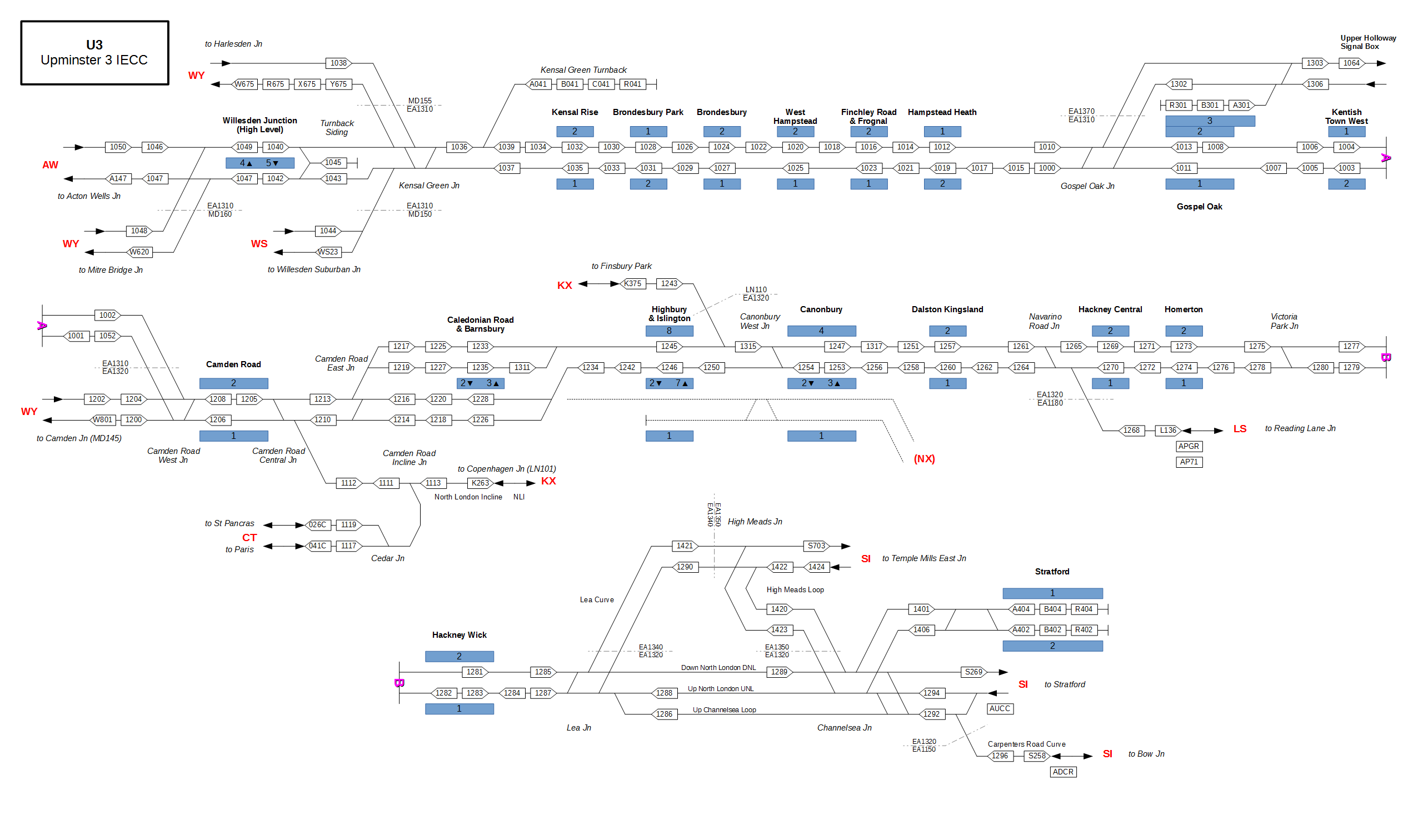
| 01:35, 10 January 2015 | TD Map U3.png (file) |  |
163 KB | Jpl | Map of TD area U3. | 1 |
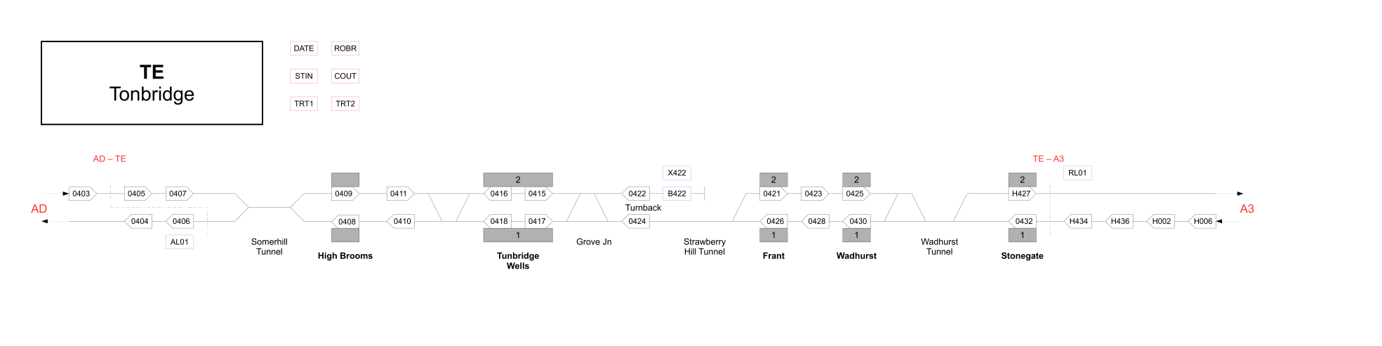
| 22:09, 6 January 2015 | TD Map TE.png (file) | 55 KB | Jpl | Map of TD area TE. | 1 | |
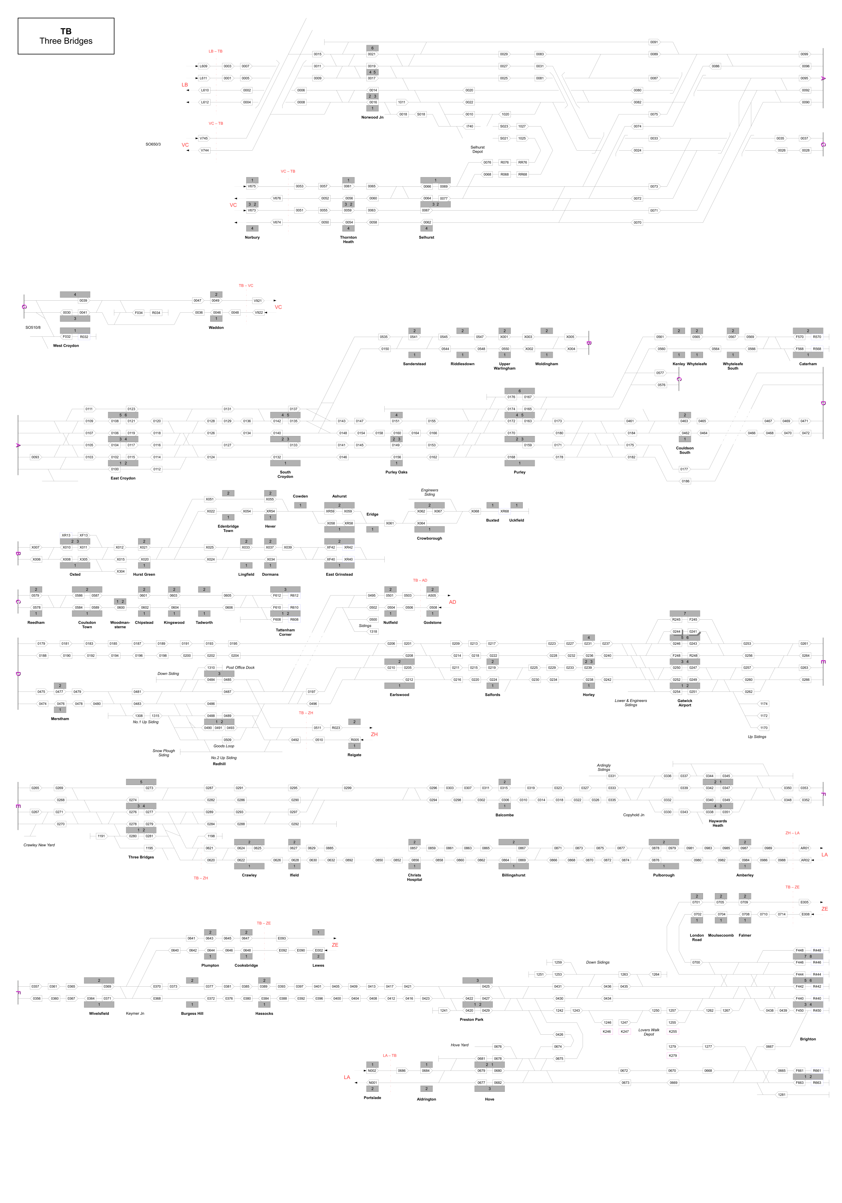
| 22:09, 6 January 2015 | TD Map TB.png (file) |  |
845 KB | Jpl | Map of TD area TB. | 1 |
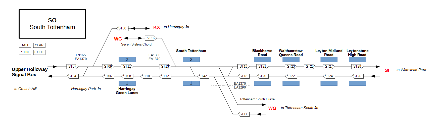
| 06:44, 10 January 2015 | TD Map SO.png (file) |  |
37 KB | Jpl | Reverted to version as of 16:28, 9 January 2015 | 3 |
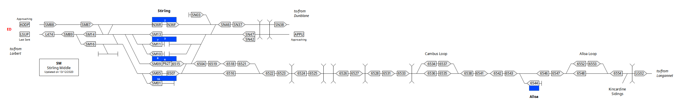
| 02:52, 13 December 2020 | TD Map SM.png (file) | 88 KB | Jpl | 1 | ||
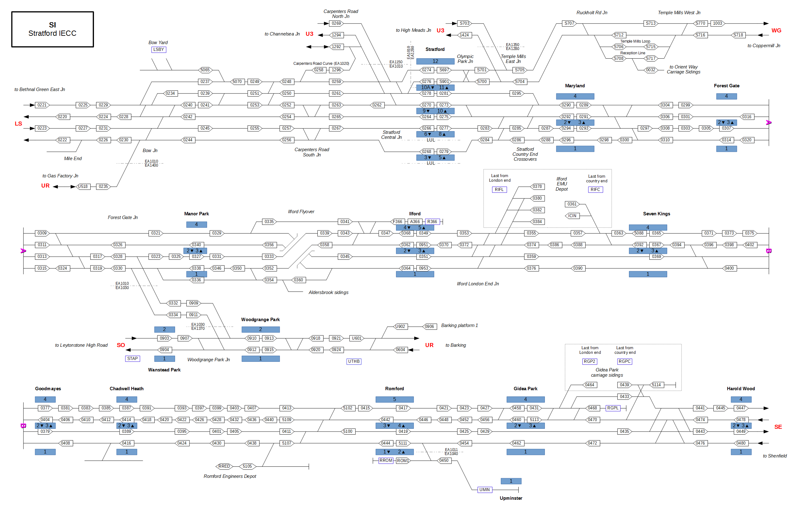
| 04:00, 14 January 2015 | TD Map SI.png (file) |  |
214 KB | Jpl | Map of TD area SI. | 1 |
| 07:23, 4 April 2022 | TD Map RT.svg (file) | 144 KB | Jpl | platform numbers | 2 | |
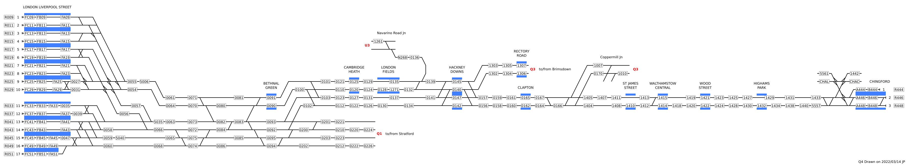
| 21:18, 19 March 2022 | TD Map Q4.png (file) | 174 KB | Jpl | Fix platforms on Hackney Downs | 2 | |
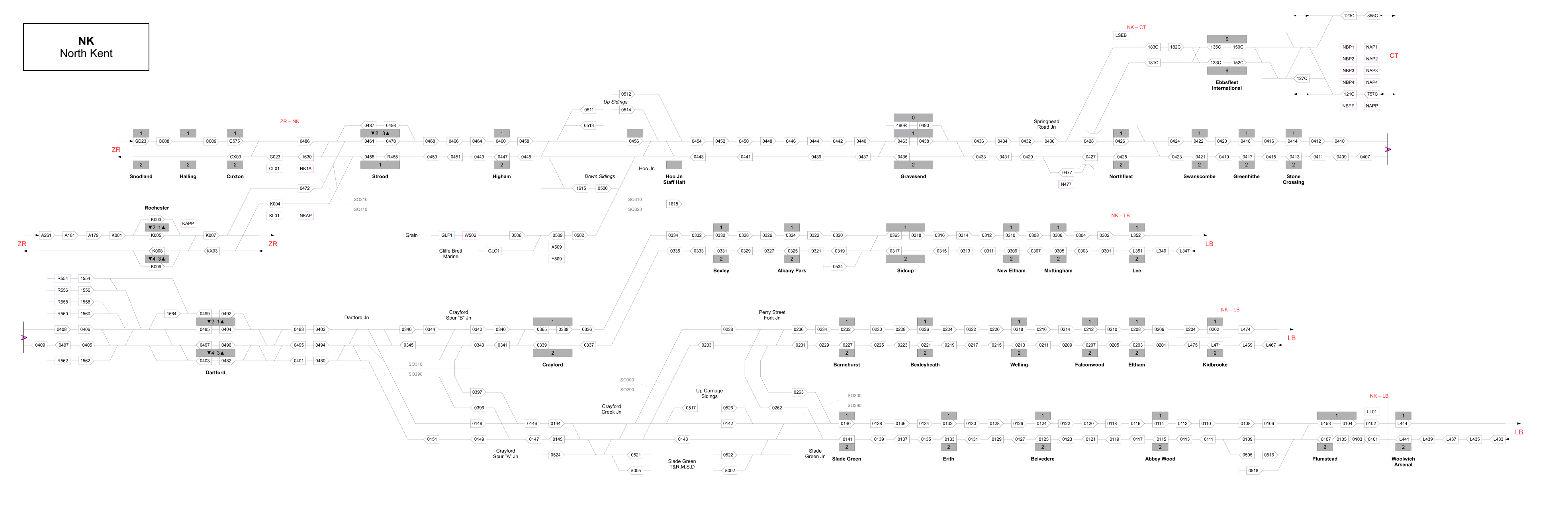
| 22:10, 6 January 2015 | TD Map NK.png (file) |  |
360 KB | Jpl | Map of TD area NK. | 1 |
| 01:23, 12 July 2015 | TD Map MA.png (file) | 49 KB | Jpl | TD Map for area MA | 1 | |
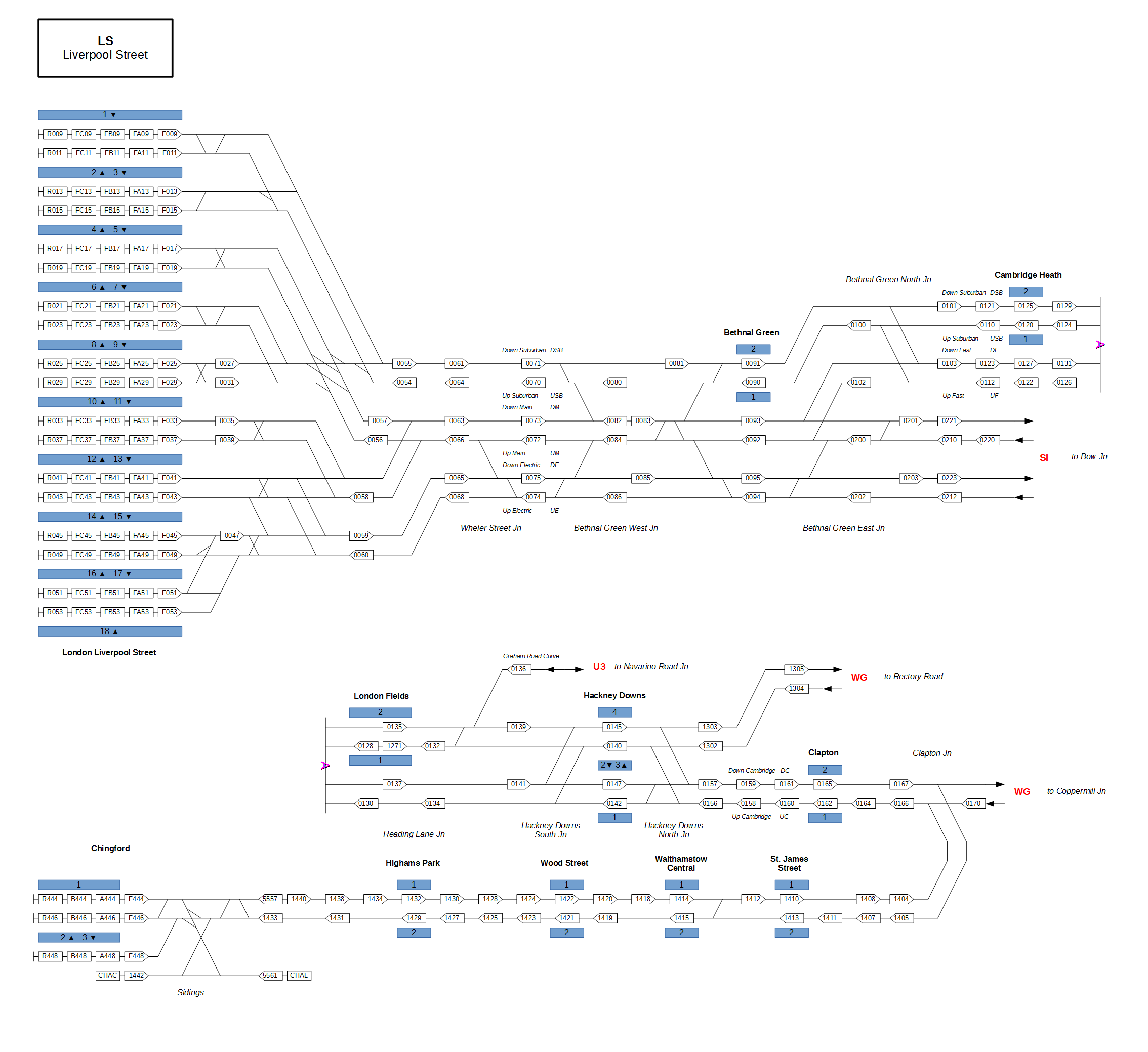
| 19:47, 10 January 2015 | TD Map LS.png (file) |  |
160 KB | Jpl | New version. | 2 |
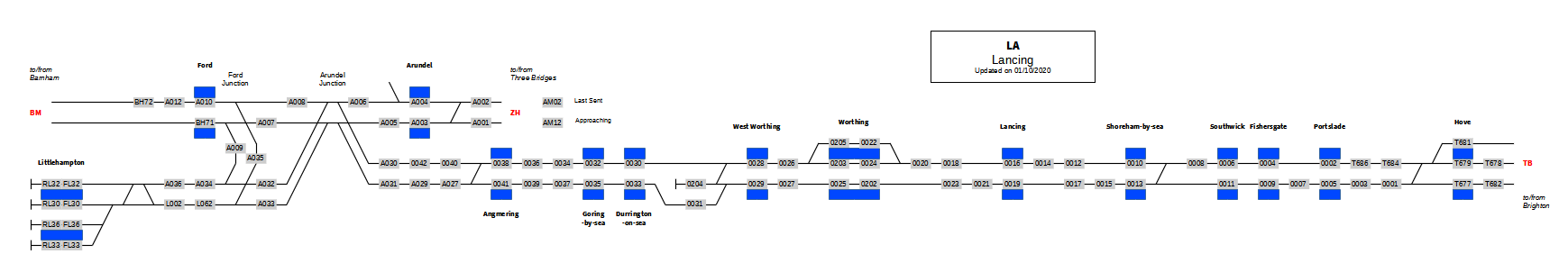
| 22:16, 1 October 2020 | TD Map LA.png (file) | 61 KB | Jpl | 1 | ||
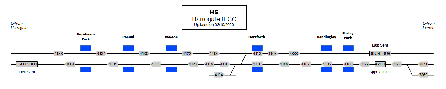
| 21:50, 2 October 2020 | TD Map HG.png (file) | 37 KB | Jpl | 1 | ||
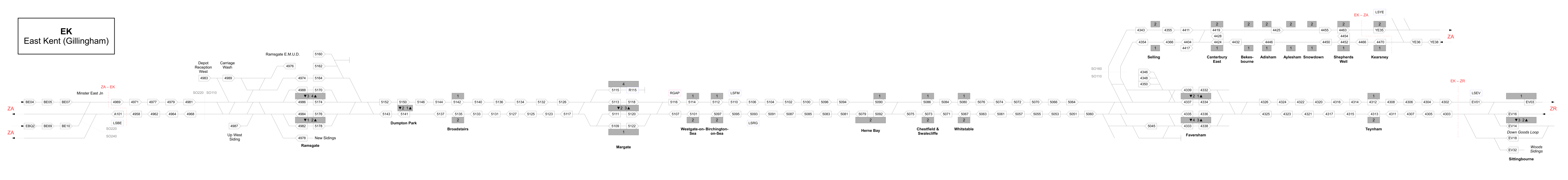
| 22:10, 6 January 2015 | TD Map EK.png (file) | 228 KB | Jpl | Map of TD area EK. | 1 | |
| 18:55, 5 April 2022 | TD Map E1.svg (file) |  |
100 KB | Jpl | 1 | |
| 21:39, 11 August 2015 | TD Map DR.png (file) | 386 KB | Jpl | Doncaster area. | 1 | |
| 17:45, 28 July 2015 | TD Map CT.png (file) |  |
216 KB | Jpl | New version. | 2 |
| 22:11, 6 January 2015 | TD Map CC.png (file) |  |
604 KB | Jpl | Map of TD area CC. | 1 |
| 01:29, 28 July 2015 | TD Map BP.png (file) |  |
47 KB | Jpl | Poole-Wool area. | 1 |
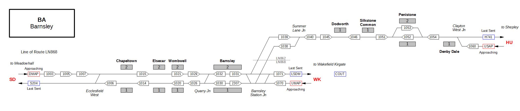
| 04:48, 3 February 2015 | TD Map BA.png (file) | 40 KB | Jpl | Map of TD area BA. | 1 | |
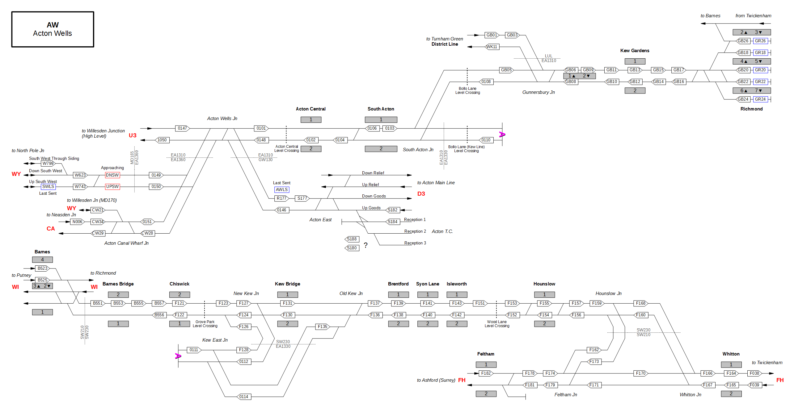
| 03:10, 3 February 2015 | TD Map AW.png (file) |  |
144 KB | Jpl | Map of TD area AW. | 1 |
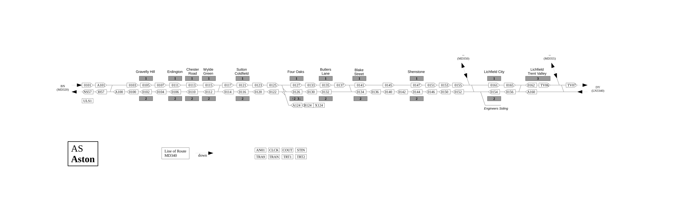
| 22:12, 6 January 2015 | TD Map AS.png (file) |  |
38 KB | Jpl | Map of TD area AS. | 1 |
| 02:00, 24 January 2016 | TD Map AN.png (file) |  |
21 KB | Jpl | Berth 3429 has been replaced with 4145. Added berth 3428. | 3 |
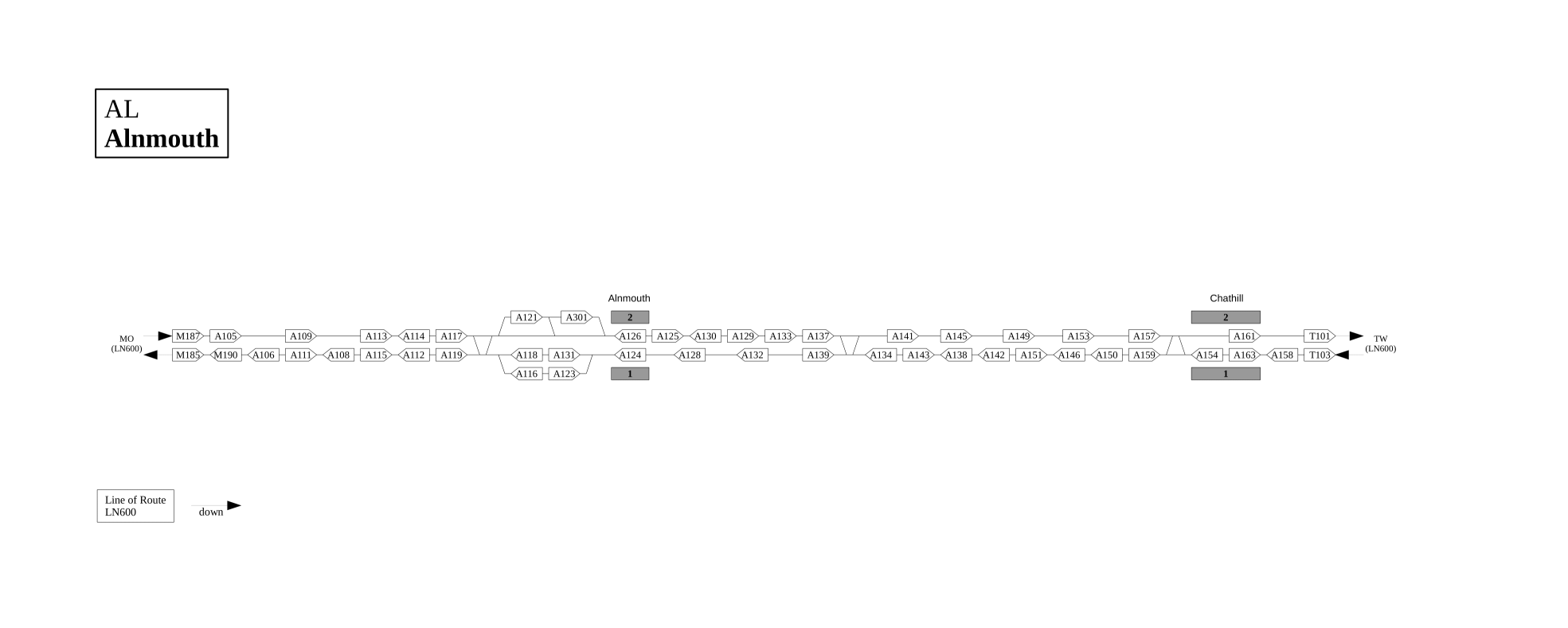
| 22:12, 6 January 2015 | TD Map AL.png (file) |  |
24 KB | Jpl | Map of TD area AL. | 1 |
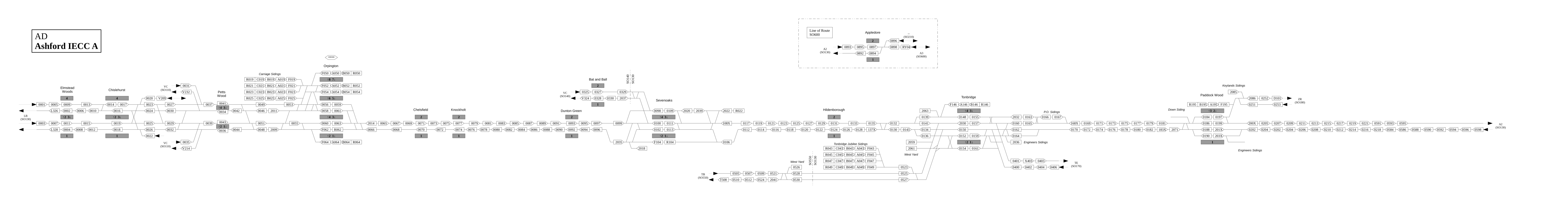
| 22:12, 6 January 2015 | TD Map AD.png (file) | 144 KB | Jpl | Map of TD area AD. | 1 | |
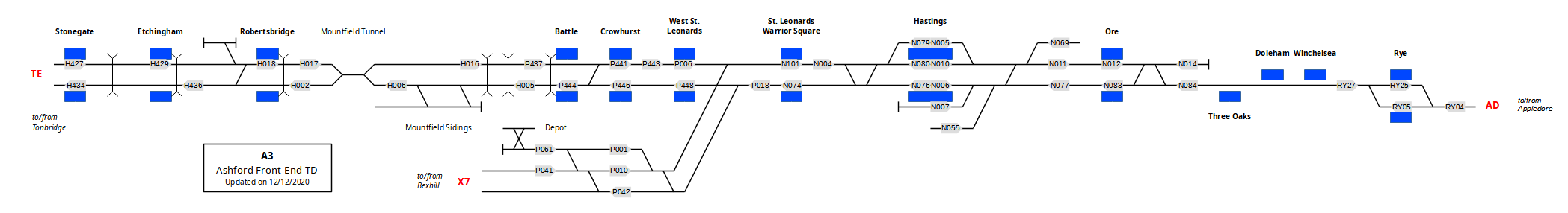
| 19:36, 12 December 2020 | TD Map A3.png (file) | 74 KB | Jpl | Redraw and fixed berth locations | 2 | |
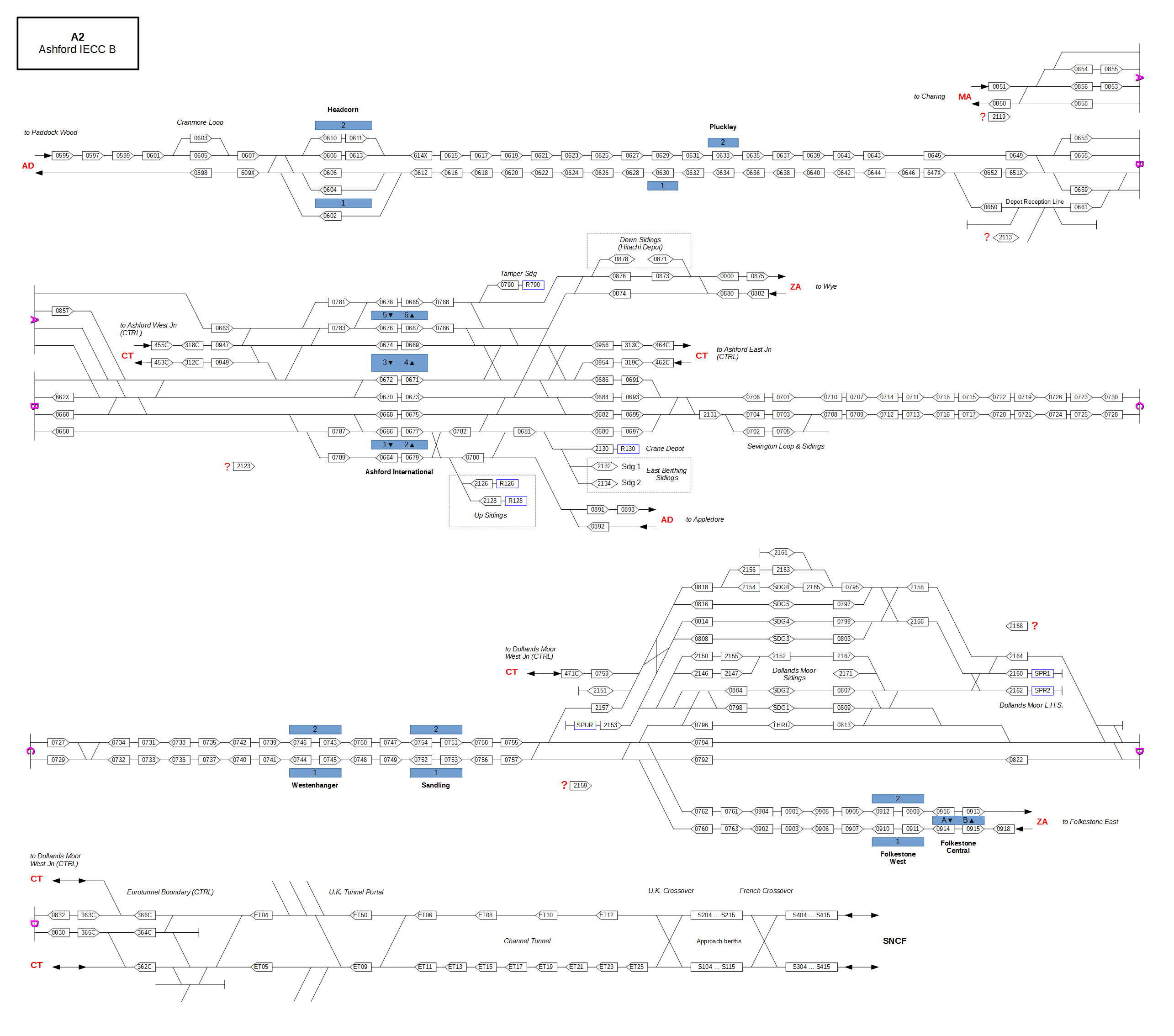
| 21:33, 19 January 2015 | TD Map A2.png (file) |  |
220 KB | Jpl | Fixed berth 471C | 3 |
| 12:11, 30 May 2016 | TB-BS-redacted-part3.tar.gz (file) | 1.55 MB | Q | TB Block Schematics - Part 3 | 1 | |
| 06:28, 13 May 2016 | TB-BS-redacted-part2.tar.gz (file) | 7.77 MB | Ian | 1 | ||
| 06:24, 13 May 2016 | TB-BS-redacted-part1.tar.gz (file) | 6.91 MB | Ian | 1 | ||
| 17:45, 12 August 2019 | Signalling symbols 2011.pdf (file) | 320 KB | Q | Symbols for Plans and Sketches used in Signalling Applications NR/L2/SIG/11201 – Mod A17 | 1 | |
| 13:35, 21 March 2016 | Scotland West Sig and Track Maps 2.tar.gz (file) | 3.27 MB | Q | Scotland_West_Sig_and_Track_Maps_2 released by NR under FoI ref: FOI2015/00984 | 1 | |
| 13:34, 21 March 2016 | Scotland West Sig and Track Maps 1.tar.gz (file) | 5.17 MB | Q | Scotland_West_Sig_and_Track_Maps_1 released by NR under FoI ref: FOI2015/00984 | 1 | |
| 17:50, 20 March 2016 | Scotland East Sig and Track Maps 4.tar.gz (file) | 6.89 MB | Q | Scotland_East_Sig_and_Track_Maps_4.tar.gz released by NR under FoI Ref: FOI2016/00155 | 1 | |
| 17:49, 20 March 2016 | Scotland East Sig and Track Maps 3.tar.gz (file) | 7.01 MB | Q | Scotland_East_Sig_and_Track_Maps_3.tar.gz released by NR under FoI Ref: FOI2016/00155 | 1 | |
| 17:47, 20 March 2016 | Scotland East Sig and Track Maps 2.tar.gz (file) | 6.71 MB | Q | Scotland_East_Sig_and_Track_Maps_2.tar.gz released by NR under FoI Ref: FOI2016/00155 | 1 | |
| 17:45, 20 March 2016 | Scotland East Sig and Track Maps 1.tar.gz (file) | 6.79 MB | Q | Scotland_East_Sig_and_Track_Maps_1.tar.gz released by NR under FoI Ref: FOI2016/00155 | 1 | |
| 17:28, 4 May 2016 | SX VDU Drawings.tar.gz (file) | 1.28 MB | Q | SX VDU Drawings. | 1 |